ISO 7010:2019 / ISO 3864-1
ISO W077 Flood zone Sign
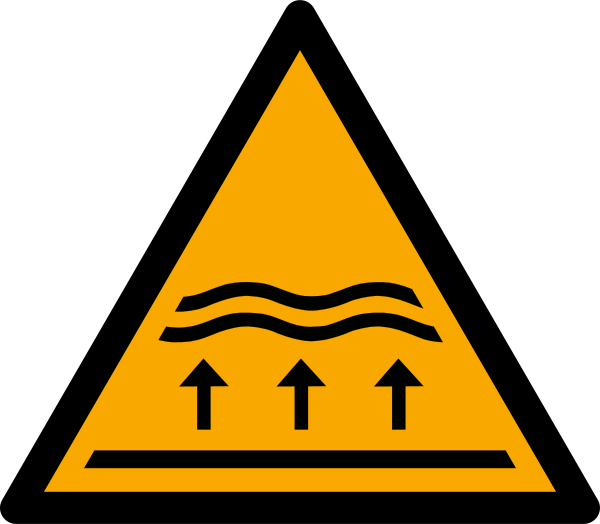
ISO W077 Flood zone Sign means the W077 sign warns that the location can flood — from rivers and lakes, overloaded urban drainage, or storm-driven coastal water — marking mapped exposure in advance so people in the zone already know their risk before the water rises. It should be used where the cited standard, facility risk assessment, SDS, emergency plan, or written safety procedure requires this hazard or safety message to be communicated.
High-Res Viewer
Reference artwork: Wikimedia Commons · License: CC0

Technical Data
| Legal Standard | ISO 7010:2019 / ISO 3864-1 |
|---|---|
| Color Codes | #FFCC00 / RAL 1003 Signal Yellow |
| Viewing Distance | 50 mm: close equipment or package label; 100 mm: approximately 5 m; 200 mm: approximately 10 m; 300 mm: approximately 15 m; 400 mm: approximately 20 m. |
| Review Status | approved / last reviewed 2026-07-07 |
| Jurisdiction Scope | Global, United States, European Union |
| Keywords | w077, iso 7010, warning, flood, zone, warn, including, from |
Standard Dimensions Table
| Sign Size | Recommended Visibility |
|---|---|
50 mm | close equipment or package label |
100 mm | approximately 5 m |
200 mm | approximately 10 m |
300 mm | approximately 15 m |
400 mm | approximately 20 m. |
Where This Sign Is Used
Municipalities and river-basin authorities install it at the boundaries of mapped inundation areas and at the spots that flood first: riverside paths, underpasses, low bridges, fords, campsites, and parking areas. Some communities reinforce it with depth poles or historic high-water marks, and complete schemes pair it with green evacuation signage such as E065 so a reader can also find the signed route to dry ground.
In-Depth Guidance
What W077 Means
W077 warns that the location can flood. The ISO 7010 register description explicitly includes flooding from inland waters, so the sign covers river and lake flooding, urban drainage overload, and coastal inundation from storm-driven water alike — any scenario where rising water can cover ground that people occupy. It is a member of the natural-hazard zone series brought into ISO 7010 by amendment, following the disaster risk-communication approach pioneered in Japanese tsunami signage and carried into ISO 22578.
The sign describes exposure, not an event in progress. Standing water arriving now is announced by flood warnings, gauges, and sirens; W077 exists so that people living in, working in, or passing through a mapped flood zone have already absorbed the fact of their exposure before the water rises. That prior awareness is what makes short official lead times survivable.
Flood Mapping Behind the Sign
Flood zones are the most systematically mapped of all natural-hazard areas. Hydrological and hydraulic modeling produces inundation maps for storms of defined probability, and many countries publish them as statutory floodplain designations that drive insurance, land-use planning, and building rules. When a municipality or river-basin authority posts W077, it is usually translating one of these mapped extents into on-the-ground communication.
Effective installations exploit that mapping precision. Signs at the boundary of an inundation area tell drivers and residents where the zone begins; signs on riverside paths, underpasses, low bridges, campsites, and parking areas mark spots that flood first. Some communities reinforce the symbol with depth poles or historic high-water marks, giving the abstract zone a vivid local calibration the pictogram alone cannot provide.
How People Should Respond
For residents, the sign is a prompt to prepare: know your evacuation route to higher ground, keep valuables and hazardous materials above expected water levels, and take flood warnings for your catchment seriously even when local weather looks calm, since rivers deliver rain that fell far upstream. For travelers, it flags places not to linger when heavy rain is forecast — riverside camps, fords, and underpasses in particular.
The most consequential single behavior in flood zones involves vehicles and moving water. A large share of flood deaths occur in cars driven into flooded crossings, because shallow, fast water can float and carry a vehicle. Public-safety campaigns worldwide condense this into the advice never to drive or walk through floodwater of unknown depth; W077 at a low crossing is a permanent carrier of that message.
Companion Signs in the ISO System
W077 handles inundation of relatively flat ground, and its neighbors divide up adjacent hazards: W076 for steep-channel debris flows and flash floods, the tsunami hazard warning of the ISO 20712-1 water-safety series for coastal tsunami zones, and W078 for unstable slopes that failures during prolonged rain can bring down. Choosing among them accurately matters, because each implies a different escape geometry — vertical for tsunamis and floods, lateral for debris flows.
The evacuation half of the system uses green safe-condition symbols. Tsunami-exposed coasts pair their warnings with E062 for evacuation areas on high ground and E063 for vertical-evacuation buildings, while general flood and disaster zones connect to E065, the natural disaster refuge sign. A flood-zone marking scheme is complete only when someone reading W077 can also see, or quickly find, the signed route to dry ground.
Frequently Asked Questions
What does the ISO 7010 W077 flood zone sign mean?
It means the area can be inundated by water — from rivers, lakes, overwhelmed drainage, or the sea — based on local flood hazard mapping. It is a standing awareness sign, not a live alert: actual flooding is announced through official flood warnings. Seeing it should prompt you to note routes to higher ground and avoid the spot during heavy rain.
Does a flood zone sign mean the area floods often?
Not necessarily. Flood maps cover events of defined probability, including rare severe floods, so a signed zone may not have flooded in living memory. The sign reflects modeled or historical exposure, and infrequent flooding is exactly when prior awareness matters most, because residents without flood experience tend to underestimate the risk.
What is the difference between W077 and the tsunami warning sign?
The tsunami hazard warning sign, registered in the ISO 20712-1 water-safety series rather than ISO 7010, specifically warns of tsunami hazard zones on coastlines, where evacuation is time-critical and driven by earthquakes offshore. W077 covers flooding generally, including from inland rivers and drainage. Coastal communities exposed to both hazards may display both, each paired with its matching evacuation signage.
Is it safe to drive through a flooded road in a marked flood zone?
No. Moving floodwater far shallower than it appears can float a car and carry it off the road, and hidden washouts can swallow wheels. Vehicle crossings are among the most common settings for flood fatalities, which is why flood-zone signs are often placed at fords, dips, and underpasses. Turn around and use an alternative route.