ISO 7010:2019 / ISO 3864-1
ISO W075 Active volcano zone Sign
ISO W075 Active volcano zone Sign means the W075 sign warns of an active volcano and the possibility of eruptions in the surrounding area — a natural-hazard zone warning telling visitors the mountain they are on is capable of erupting, so shelter locations and descent routes should be learned in advance. It should be used where the cited standard, facility risk assessment, SDS, emergency plan, or written safety procedure requires this hazard or safety message to be communicated.
High-Res Viewer
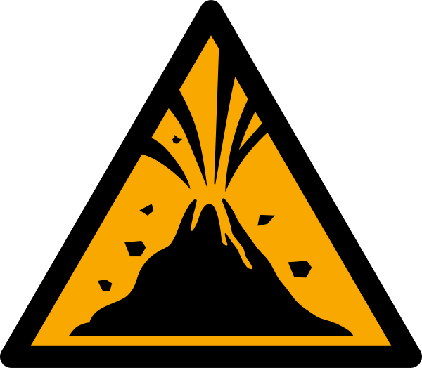
Reference artwork: Wikimedia Commons · License: CC0

Technical Data
| Legal Standard | ISO 7010:2019 / ISO 3864-1 |
|---|---|
| Color Codes | #FFCC00 / RAL 1003 Signal Yellow |
| Viewing Distance | 50 mm: close equipment or package label; 100 mm: approximately 5 m; 200 mm: approximately 10 m; 300 mm: approximately 15 m; 400 mm: approximately 20 m. |
| Review Status | approved / last reviewed 2026-07-07 |
| Jurisdiction Scope | Global, United States, European Union |
| Keywords | w075, iso 7010, warning, active, volcano, zone, warn, volcanic |
Standard Dimensions Table
| Sign Size | Recommended Visibility |
|---|---|
50 mm | close equipment or package label |
100 mm | approximately 5 m |
200 mm | approximately 10 m |
300 mm | approximately 15 m |
400 mm | approximately 20 m. |
Where This Sign Is Used
Park and mountain administrations, municipalities at a volcano's base, and tourism operators post it at trailheads, crater-rim approaches, ropeway and visitor-center entrances, and valley locations exposed to lahar paths, following published hazard maps rather than a uniform radius around the peak. On heavily visited volcanoes it anchors displays combining the current alert level, closure notices, and maps of eruption shelters and evacuation routes.
In-Depth Guidance
What the W075 Sign Tells You
W075 warns of an active volcano and the possibility of volcanic eruptions in the surrounding area. It is one of the ISO 7010 natural-hazard zone warnings introduced by amendment for public disaster risk communication, a sign family that grew out of Japanese work on standardized tsunami and disaster signage and the broader ISO 22578 natural-disaster guidance-system approach. Japan, with dozens of active volcanoes drawing hikers and tourists, is a natural home for exactly this symbol.
Active in this context means the volcano is considered capable of erupting, not that an eruption is underway. Volcanic crises are announced through observatory alert levels, sirens, and access closures. W075 provides the constant baseline message: the mountain you are walking on can erupt, so learn the shelter locations and descent routes before you need them.
Volcanic Hazards Behind the Symbol
An eruption zone bundles several distinct dangers. Close to a vent the immediate threats are ballistic blocks — rocks ejected on eruptive bursts — along with ash clouds, hot gases, and pyroclastic flows. Farther out, heavy ashfall, volcanic gas accumulation in hollows and craters, and lahars, the volcanic mudflows that race down river valleys long after an eruption, extend the risk footprint well beyond the summit.
Because these dangers have different geographies, volcano authorities publish hazard maps that divide the mountain into zones by expected phenomena. W075 signage typically follows those maps: posted at trailheads, crater-rim approaches, ropeway and visitor-center entrances, and valley locations exposed to lahar paths, so the sign's position itself reflects scientific hazard assessment rather than a uniform radius around the peak.
Posting Practice on Active Volcanoes
The organizations behind W075 installations are park and mountain administrations, municipalities at the volcano's base, and tourism operators managing trails, cable cars, and summit facilities. On heavily visited volcanoes the symbol often appears alongside the current alert level, area closure notices, and maps showing concrete shelters and evacuation routes — the pictogram anchors the display for international tourists with no command of the local script.
Some volcano trails also feature purpose-built eruption shelters and helmet-loan stations. Where they exist, W075 should be part of a chain that leads to them, in the same way tsunami zone signage pairs with the E062 and E063 evacuation signs and inland hazards pair with the E065 natural disaster refuge symbol. The warning sign raises the question of where safety lies; guidance signage must answer it.
Reading W075 as a Visitor
If you encounter this sign at a trailhead, treat it as an instruction to prepare rather than to turn back. Check the volcano's current alert status before ascending, respect any closure lines, note shelter huts and rock formations that could protect against falling ejecta, and keep track of the fastest descent route. In gas-prone areas, avoid lingering in depressions where heavier-than-air volcanic gases can pool.
During a sudden eruption, guidance from volcano authorities is broadly consistent: protect your head, move crosswise out of the path of flows and ashfall rather than straight down drainage channels, shelter behind solid terrain or in designated structures until ballistic activity subsides, and then descend. Knowing this before the sign becomes relevant is precisely what pre-event zone signage is for.
Frequently Asked Questions
What does the ISO W075 active volcano sign mean?
It marks an area where an active volcano can erupt and expose people to hazards such as ejected rocks, ash, gases, pyroclastic flows, and volcanic mudflows. It signals standing risk based on the volcano's hazard map, not a current eruption; live eruption information comes from observatory alert levels and official warnings.
Can I hike a volcano that has W075 warning signs?
Often yes. Many active volcanoes remain open to hikers when their alert level is low, and the sign exists precisely because visitors are expected. Check the current alert level before you go, obey closures, note shelters and descent routes on the way up, and carry protection for your head and airways if local guidance recommends it.
Where are active volcano zone signs usually placed?
At trailheads, crater approaches, visitor centers, ropeway stations, and settlements or valleys inside mapped hazard areas, including lahar-exposed river corridors. Placement generally follows the official volcanic hazard map, so signs mark scientifically assessed exposure rather than a simple distance from the summit.
What evacuation signs go together with W075?
In the ISO system, warning-zone signs pair with green safe-condition signs. For volcanic areas the natural companion is E065, the natural disaster refuge sign, plus locally marked eruption shelters and evacuation route arrows. The pairing turns a bare warning into a usable plan: here is the risk, and there is the way out.