ISO 7010:2019 / ISO 3864-1
ISO E062 Tsunami evacuation area Sign
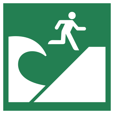
ISO E062 Tsunami evacuation area Sign means the E062 sign designates a tsunami evacuation area — a safe assembly place, normally on high ground outside the projected inundation zone, that people should move to when a warning is issued or when natural signs such as a strong earthquake or sudden sea withdrawal demand immediate self-evacuation. It should be used where the cited standard, facility risk assessment, SDS, emergency plan, or written safety procedure requires this hazard or safety message to be communicated.
High-Res Viewer
Reference artwork: Wikimedia Commons · License: CC0

Technical Data
| Legal Standard | ISO 7010:2019 / ISO 3864-1 |
|---|---|
| Color Codes | #009933 / RAL 6032 Signal Green |
| Viewing Distance | 100 mm: approximately 5 m; 200 mm: approximately 10 m; 300 mm: approximately 15 m; 400 mm: approximately 20 m; 600 mm: approximately 30 m. |
| Review Status | approved / last reviewed 2026-07-07 |
| Jurisdiction Scope | Global, United States, European Union |
| Keywords | e062, iso 7010, emergency, tsunami, evacuation, area, indicate, location, safe, place, uphill |
Standard Dimensions Table
| Sign Size | Recommended Visibility |
|---|---|
100 mm | approximately 5 m |
200 mm | approximately 10 m |
300 mm | approximately 15 m |
400 mm | approximately 20 m |
600 mm | approximately 30 m. |
Where This Sign Is Used
Coastal municipalities and emergency planners post it at the assembly area itself and as directional signs with arrows at every decision point along evacuation routes from beaches, harbors, and low-lying districts, often adding distances or walking times to improve compliance. Panels are mounted high enough to stay visible over crowds, made reflective or illuminated for night evacuations, and maintained against salt-air corrosion, typically paired with W077 flood-zone warnings and the E063 vertical evacuation building sign.
In-Depth Guidance
What ISO 7010 E062 Means
E062 designates a tsunami evacuation area: a safe assembly place, normally on high ground, that people should move to when a tsunami warning is issued or when natural signs — a strong or long earthquake, a sudden withdrawal of the sea — demand immediate self-evacuation. The pictogram shows a figure running up a slope above a stylized wave, on the green safe-condition square, and it means go here and stay here until authorities give the all-clear.
The symbol belongs to the family of tsunami and disaster signs that grew out of Japanese public-safety signage and were carried into international standardization after the catastrophic tsunamis of the 2000s and 2010s exposed how badly tourists and visitors need language-free guidance. Adopted into ISO 7010, the same pictogram can now anchor evacuation routes from Japan to Chile to the Mediterranean.
E062 Versus E063 and E065
ISO 7010 splits tsunami refuge into two distinct destinations. E062 marks horizontal evacuation — an open area at elevation, outside the projected inundation zone, reached by moving inland and uphill. E063 marks vertical evacuation — a designated building strong and tall enough to climb above the water when high ground cannot be reached in time. Coastal evacuation planning typically signs both, with E062 as the preferred destination and E063 as the fallback for low-lying flats.
E065, the natural disaster outdoor refuge area, is the all-hazards cousin: it marks open assembly spaces designated for earthquakes, urban fire, and other disasters generally, without implying elevation or tsunami safety. A riverside park can legitimately carry E065 for earthquake refuge and simultaneously sit inside a tsunami inundation zone — which is exactly why the tsunami-specific symbols exist.
Placement Along the Evacuation Route
The destination sign is only the last link. Effective tsunami wayfinding starts with hazard-zone marking — the ISO warning series covers coastal and flood hazards, and companion signs such as W077 (flood zone) flag related inundation risks — continues with directional E062 signs with arrows at every decision point on the route, and ends with the plain E062 panel at the assembly area itself. Distances or walking times added as supplementary text measurably improve compliance, because people decide whether to run based on how far safety is.
Siting details matter more here than for almost any other safe-condition sign: panels must be legible to pedestrians and drivers, mounted high enough to remain visible over crowds, reflective or illuminated for night evacuations, and maintained against salt-air corrosion. Tsunamis following near-field earthquakes can arrive within tens of minutes, so the signage must work for people navigating at a run, without local knowledge, possibly in darkness.
Frequently Asked Questions
What does the tsunami evacuation area sign mean?
It marks a designated safe assembly place — typically elevated ground outside the mapped inundation zone — where people should go during a tsunami warning. The green ISO 7010 E062 sign with a figure running uphill above a wave appears both as arrowed route markers pointing toward the area and as a destination panel at the site itself.
What is the difference between a tsunami evacuation area and a tsunami evacuation building?
The evacuation area (E062) is open high ground you reach by moving inland and uphill — the preferred option. The evacuation building (E063) is an engineered structure designated for vertical evacuation, used where flat coastal terrain means high ground cannot be reached before waves arrive. Plans in low-lying communities usually sign both so people take whichever is reachable in the time available.
Should I wait for an official warning before going to a tsunami evacuation area?
No. For tsunamis generated by nearby earthquakes, the shaking itself is the warning — waves can arrive before sirens or phone alerts. Standard guidance is to start moving to the signed evacuation area immediately after strong or unusually long shaking, or if the sea suddenly recedes, and to stay at elevation until authorities declare the event over, since tsunamis arrive as a series of waves.
Who decides where tsunami evacuation areas are located?
Local civil protection or emergency management authorities, working from inundation modelling of credible tsunami scenarios. They designate assembly sites above and beyond the modelled flood line, plan pedestrian routes that avoid bridges and choke points, and install the E062 signage. Residents and businesses in the zone should learn the routes in advance rather than reading signs for the first time during an event.